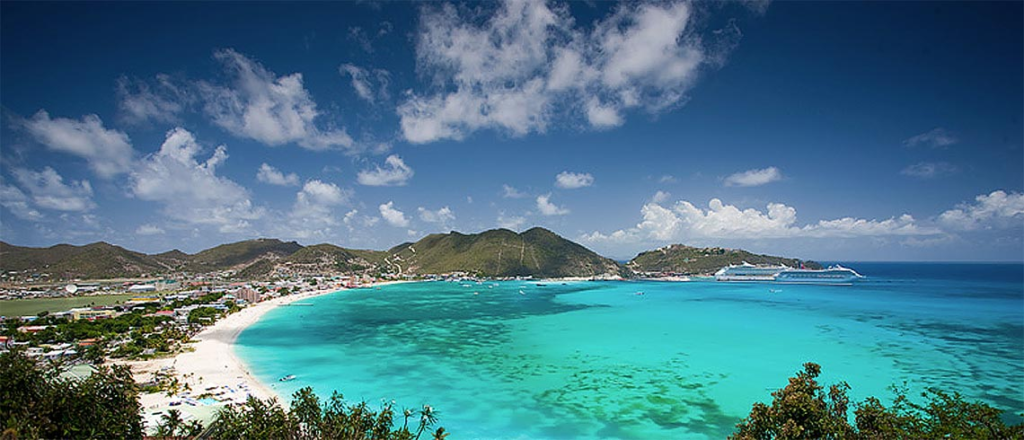

At the south east of the island is an area called Point Blanche. The first Dutch named it “Witte Punt” describing the whitish coloured cliffs rising up out of the sea when approached by ship. The layered rock formation named Point Blanche formation so visible here, resulted from hardened layers of tuft spewed from subvolcanic eruptions deposited on the seabed some 50 million year ago. These layers were later on raised above sea level by the earth crust’s movements. The area was uninhabited but for a small leprosy colony until a road was built in the sixties, opening up the site with houses, port related businesses and a prison. For those who love hiking, two route goes to Point Blanche , the Guana Bay area and the Vineyard.
Point Blanche is located close to the AC Wathey Cruise Port, near Philipsburg. Depending on your location within Point Blanche, the area offers great views of Great Bay and Philipsburg, as well as St Barths , Statia and Saba.
See our overview of St. Maarten taxi rates what pricing is in place from Point Blanche to your place of departure.
Find the Point Blanche area on the map below!
• Spend a day on the water with Eagle Tours
• Spend a day at Little Bay Beach, take a one day Divi Little Bay Resort pass and/or enjoy a meal at Gizmo’s or PureOcean!
• Take a pirate history tour at the Rusty Parrot! Enjoy the true history of buccaneers during a unique visual experience.
• Take the Philipsburg Mural tour!
• Do an active Philipsburg Tri-Sport tour!
• Explore St. Maarten’s underwater paradise with Dive Sint Maarten.
• Explore the waters of Sint Maarten with Aqua Manias Boat Tours
• Explore Philipsburg during the St Martin Philipsburg City Walk.
• Go and visit Yoda Guy Movie Exhibit. It’s a small non-profit museum with a lot of movie (Starwars) history packed inside.
• See our national symbol the Courthouse!
• Make an AMAsterdam bar selfie in an Amsterdam streetcar or “red light district”!
• Visit the Heritage Museum
• Spend a beach day at Great Bay Beach, and don’t forget to take lunch at the Ocean Lounge.
• Try a rum of local manufacturer guavaberry made of namesake fruits that grow on the island.
• Watch your favorite sports match while enjoying a cold drink at St. Rose Café & Bar.
General Information About St. Maarten / St. Martin Page
Excursions & Activities on St. Maarten / St. Martin Page
